Quilt Pattern

Monkey Wrench

Located in Dandridge, this waypoint along the Quilt Trail is part of Jefferson County, within the East Tennessee region.

MAIN INFORMATION

The family still raises sheep, cattle, rabbits and chickens on this farm.

{ waypoint }

CONTACT INFORMATION

820 R. H. Ellis Road
Dandridge, Tennessee


LOCATION MAP

36.03216 °N, -83.48795 °W
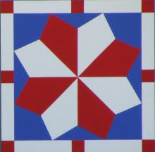
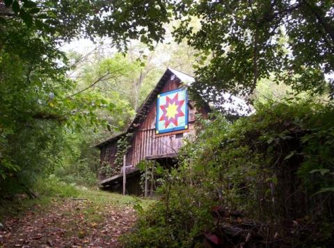
Quilt Pattern

Mark's Star

Located in Strawberry Plains, this waypoint along the Quilt Trail is part of Jefferson County, within the East Tennessee region.

MAIN INFORMATION

The pattern is based on a quilt that the Holland son had as a baby.

{ waypoint }

CONTACT INFORMATION

357 Barber Road
Strawberry Plains, Tennessee


LOCATION MAP

36.04626 °N, -83.66611 °W

Quilt Pattern

Mariner's Compass

Located in Jefferson City, this waypoint along the Quilt Trail is part of Jefferson County, within the East Tennessee region.

MAIN INFORMATION

The Wilsons are avid admirers of lighthouses, so this square is fitting with its name and the 3D replica of a lighthouse in the middle.

{ waypoint }

CONTACT INFORMATION

1309 Clinch View Circle
Jefferson City, Tennessee


LOCATION MAP

36.12138 °N, -83.46529 °W

Quilt Pattern

Maize Daze/ Prism Trail

Located in Jefferson City, this trail stop along the Quilt Trail is part of Jefferson County, within the East Tennessee region.

MAIN INFORMATION

Designed and painted by Regann Hunt, this is one of 2 quilts done by her for the 2 barns on the Simpson Farm. Five generations have worked this farm that was established in 1896. Just off Hwy 92 in Jefferson City.

{ trail stop }

CONTACT INFORMATION

1915 Bethel Church Rd
Jefferson City, Tennessee


LOCATION MAP

36.12652 °N, -83.518149 °W

Quilt Pattern

Lone Star

Located in Dandridge, this waypoint along the Quilt Trail is part of Jefferson County, within the East Tennessee region.

MAIN INFORMATION

This square was made in memory of family who moved to the area 60 years ago. At holiday time, the barn is decorated and lit up for the season.

{ waypoint }

CONTACT INFORMATION

884 Chestnut Grove Road
Dandridge, Tennessee


LOCATION MAP

36.06251 °N, -83.41693 °W

Quilt Pattern

Kramer's Quilt

Located in Strawberry Plains, this waypoint along the Quilt Trail is part of Jefferson County, within the East Tennessee region.

MAIN INFORMATION

The homestead was built sometime before the Civil War and has since been restored. The quilt pattern is based off of a family quilt and is on the barn near the house.

{ waypoint }

CONTACT INFORMATION

2590 Day Road
Strawberry Plains, Tennessee


LOCATION MAP

36.09765 °N, -83.63072 °W

Quilt Pattern

Lemoyne Star

Located in Jefferson City, this waypoint along the Quilt Trail is part of Jefferson County, within the East Tennessee region.

MAIN INFORMATION

This land was purchased in 1792 as a land grant from North Carolina. The log cabin was built in 1830 and still stands today.

{ waypoint }

CONTACT INFORMATION

912 Whitaker Road
Jefferson City, Tennessee


LOCATION MAP

36.08031 °N, -83.59277 °W

Pages

Subscribe to Appalachian Quilt Trail RSS