

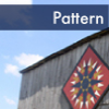

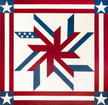
Quilt Pattern
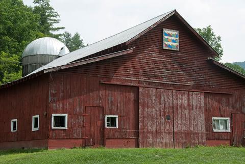
Diane's Passion
Located in Bryson City, this waypoint along the Quilt Trail is part of
Swain County, within the
Mountain North Carolina region.
This trailstop is a member of the Swain County Quilt Trail trail.
MAIN INFORMATION
Appalachian Dream is a design that captures the traditional elements of mountain quilts while using the natural colors to be found in the woods on an autumn day. The first quilt square to be hung in Bryson City / Swain County, Appalachian Dream is a fitting representative of the area and its people, culture, and heritage.
{ waypoint }
CONTACT INFORMATION
300 Everett Street
Bryson City, North Carolina
Bryson City, North Carolina
LOCATION MAP
35.431285 °N, -83.447457 °W
Quilt Pattern
Indian Trail,
Celtic Chain,
Red Flower Bud
Located in Bryson City, this waypoint along the Quilt Trail is part of
Swain County, within the
Mountain North Carolina region.
This trailstop is a member of the Swain County Quilt Trail trail.
MAIN INFORMATION
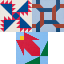
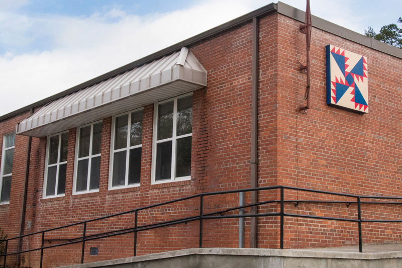
Indian Trail
Location: South side of the building, facing Hwy 74.
The Indian Trail quilt square was selected to represent both the proximity of the Swain Center to the Qualla Boundary as well as the Little Tennessee River, which was the last boundary of the Cherokee Nation before removal in 1838. The square also represents the College’s commitment to keeping the “trail” open and clear for all students seeking to better themselves through education.
Celtic Chain
Location: West facing building entrance
The Celtic Chain’s interwoven links represent the connections of the College with the community; students, faculty, family, and friends as well as business, education, service, and collaboration.
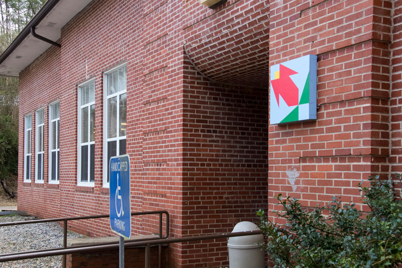
Red Flower Bud
Location: North end of the building
The Red Flower Bud square represents the beauty found in our community, both natural and man-made.
{ waypoint }

CONTACT INFORMATION
60 Almond School Road
Bryson City, North Carolina
Bryson City, North Carolina
LOCATION MAP
35.372771 °N, -83.506433 °W
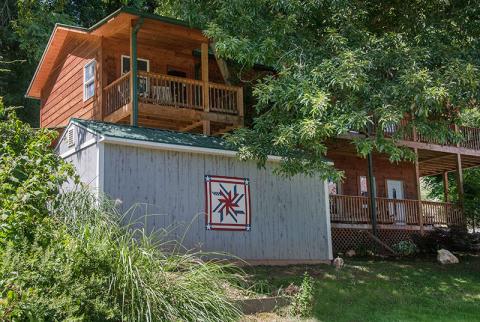
Gallery

Quilt Pattern
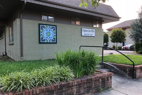
American Dream
Located in Bryson City, this waypoint along the Quilt Trail is part of
Swain County, within the
Mountain North Carolina region.
This trailstop is a member of the Swain County Quilt Trail trail.
MAIN INFORMATION
The Calhoun House is a historic landmark in Bryson City. It was built as a hotel in 1920, and in the 1930s was converted into apartments for the men working to build Fontana Dam. It remained in the Calhoun family for 70 years. In 2006, Edward and Shirley Ciociola purchased it and have restored its former beauty including its heart pine flooring, transom windows, and extensive covered porches. The design is inspired by the Ciociola’s extensive travel throughout the United States that eventually led them back to the Western North Carolina mountains and the Calhoun House, an American landmark.
{ waypoint }
CONTACT INFORMATION
110 Bryson Avenue
Bryson City, North Carolina
Bryson City, North Carolina
LOCATION MAP
35.431287 °N, -83.449811 °W

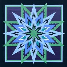
Quilt Pattern
Around Deep Creek
Located in Bryson City, this waypoint along the Quilt Trail is part of
Swain County, within the
Mountain North Carolina region.
This trailstop is a member of the Swain County Quilt Trail trail.
MAIN INFORMATION
This custom design was created to demonstrate the variety of activities and scenic beauty in Deep Creek Valley where the campground is located. The block is on the tube barn, where visitors rent inner tubes to ride down splashy Deep Creek in the Great Smoky Mountains National Park. The blue waters of Deep Creek – as depicted in the block – flow right next to the campground. The green outer border represents the mountains and the green leaves in the center represent the local conifers. Cabins are the darker yellow shapes; tents are the red corner markers. The campground also has goats, which may be found in the yellows with their eyes the darker yellow spots. And, of course, the tube shape ties the block together.
{ waypoint }
CONTACT INFORMATION
1090 West Deep Creek Road
Bryson City, North Carolina
Bryson City, North Carolina
LOCATION MAP
35.448558 °N, -83.444095 °W
Quilt Pattern
East Alarka Mountains
Located in Bryson City, this waypoint along the Quilt Trail is part of
Swain County, within the
Mountain North Carolina region.
This trailstop is a member of the Swain County Quilt Trail trail.
MAIN INFORMATION
For many years the Oliver family owned hundreds of acres on East Alarka. In the early 1950s Mr. Ralph Wiggins purchased a tract of land previously owned by an Oliver family member. He built a big red barn, which became known as a landmark for the community. Upon his death, his wife established Red Barn Campground and began having square dancing every Saturday night. After her death, John & Freda Livingston purchased the property and established Smoky Mountain Meadows Campground. This barn still stands today looking out at the East Alarka Mountains, which we honor with our quilt square.
{ waypoint }
CONTACT INFORMATION
755 East Alarka Road
Bryson City, North Carolina
Bryson City, North Carolina
LOCATION MAP
35.37594 °N, -83.456282 °W
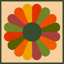
Quilt Pattern
Dresden Plate
Located in Bryson City, this waypoint along the Quilt Trail is part of
Swain County, within the
Mountain North Carolina region.
This trailstop is a member of the Swain County Quilt Trail trail.
MAIN INFORMATION
In 1978 former owner & basketmaker Debbie Mills took a quilting class and learned how to hand piece a block called the Dresden Plate. When the block was finished, it was carefully wrapped and tucked away. 21 years later she brought it out to show it to her good friend. The friend quietly took the piece, intending to have it framed immediately. One year led to five and still it was not framed. By now Debbie thought she had lost it. To her great surprise in the 6th year, her friend gave her back the piece which had been beautifully framed and is now on display in the gallery. The Dresden Plate was one of the most popular quilt patterns used during the 1920s and 30s. The pattern reflects the romance of the Victorian Era with its love of elaborate decoration on household items and decor; and the admiration women had for the beautiful plates of Dresden, Germany, which were embellished with flowers, fruits and foliage.
{ waypoint }
CONTACT INFORMATION
19 Everett Street
Bryson City, North Carolina
Bryson City, North Carolina
LOCATION MAP
35.427681 °N, -83.445499 °W
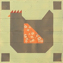
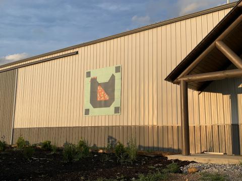
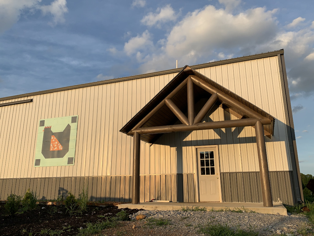
Quilt Pattern
Graceful Hen
Located in Red Boiling Springs, this waypoint along the Quilt Trail is part of
Clay County, within the
Middle Tennessee region.
MAIN INFORMATION
Acres of Grace Farms has been a family farm for three generations. The "graceful hen" design was chosen because the farm has always had hens that have provided eggs for the family. They grow vegetables, sell their farm raised beef, and host a barn sale twice per year for people to shop, eat, and take a tour of the farm. The family "takes pride in stewardship, sustainability, and servanthood" on the farm.
{ waypoint }
CONTACT INFORMATION
2258 Henson Rd
Red Boiling Springs, Tennessee
acresofgracefarms.com
Red Boiling Springs, Tennessee
acresofgracefarms.com
LOCATION MAP
36.565163 °N, -85.723911 °W
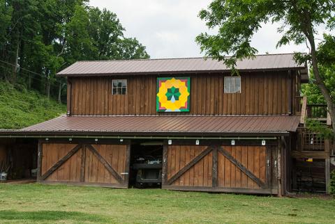
Gallery

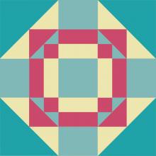
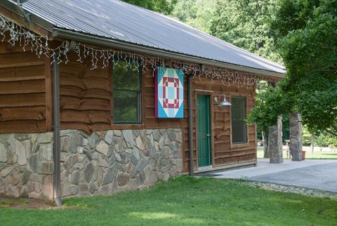
Quilt Pattern
Harmony Square
Located in Bryson City, this waypoint along the Quilt Trail is part of
Swain County, within the
Mountain North Carolina region.
This trailstop is a member of the Swain County Quilt Trail trail.
MAIN INFORMATION
The Harmony Square was placed at Harmony Hall at the center of our grounds. The quilt square is to remind us of the harmony we hope to provide in the hectic and not always harmonious world we live in. And also to pay tribute to those who pioneered these mountains so that we and our guests can enjoy nature’s beauty.
{ waypoint }
CONTACT INFORMATION
3336 Balltown Road
Bryson City, North Carolina
Bryson City, North Carolina
LOCATION MAP
35.442774 °N, -83.481605 °W